
Image: Pangea assembly 310
Size of this preview: 800 × 566 pixels. Other resolutions: 320 × 226 pixels | 1,123 × 794 pixels.
Original image (1,123 × 794 pixels, file size: 60 KB, MIME type: image/png)
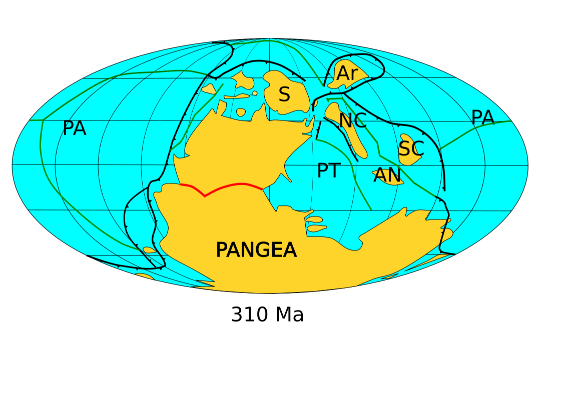
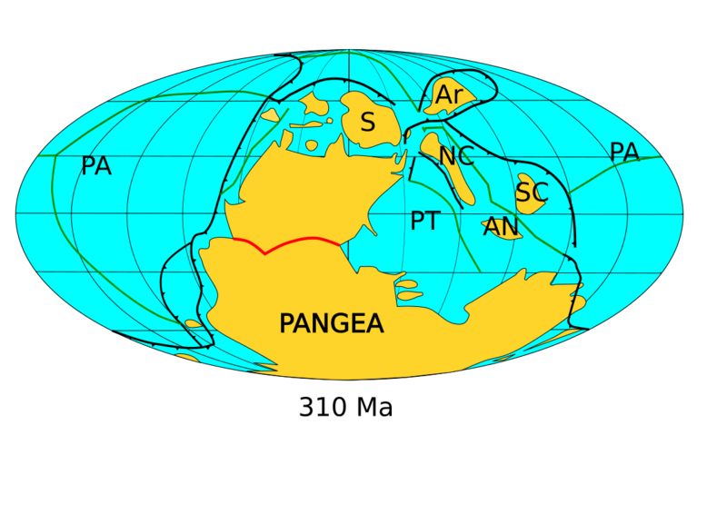
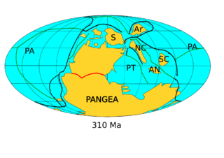
Description: This map depicts the positions of continental blocks around 310 Ma, in the late Carboniferous. S=Siberia; Ar=Amuria, NC=North China, SC=South China, AN=Annamia, PA=Panthalassic Ocean, PT=Paleothethys Ocean. Orogens shown in red. Subduction zones shown in black. Spreading centers shown in green. Based on Torsvik and Cocks (2017) Earth History and Paleogeography, ISBN 978-1-107-10532-4, p.161.
Title: Pangea assembly 310
Credit: Own work
Author: Kent G. Budge
Usage Terms: Creative Commons Zero, Public Domain Dedication
License: CC0
License Link: http://creativecommons.org/publicdomain/zero/1.0/deed.en
Attribution Required?: No
Image usage
The following page links to this image:

All content from Kiddle encyclopedia articles (including the article images and facts) can be freely used under Attribution-ShareAlike license, unless stated otherwise.