
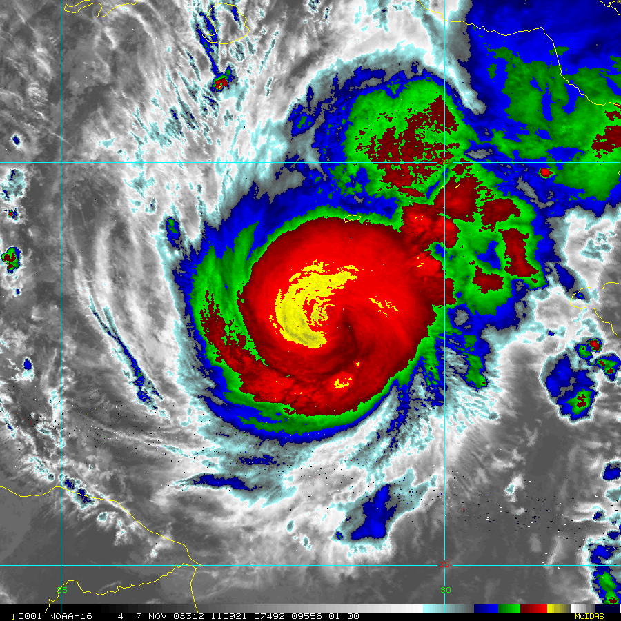
Image: Paloma IR nov 7 2008 1109 UTC
Size of this preview: 600 × 600 pixels. Other resolutions: 240 × 240 pixels | 900 × 900 pixels.
Original image (900 × 900 pixels, file size: 385 KB, MIME type: image/gif)
Description: Infrared satellite image of Hurricane Paloma taken by 1 km Mercator, MODIS/AVHRR Satellite on November 7, 2008 at 1109 UTC (5:09 EST). At the time this image was taken, Hurricane Paloma had sustained winds of 75mph (120 km/h).
Title: Paloma IR nov 7 2008 1109 UTC
Credit: NOAA RAMMB MODIS Infrared archive
Author: NOAA and NASA
Permission: Public Domain
Usage Terms: Public domain
License: Public domain
Attribution Required?: No
Image usage
The following page links to this image:

All content from Kiddle encyclopedia articles (including the article images and facts) can be freely used under Attribution-ShareAlike license, unless stated otherwise.