
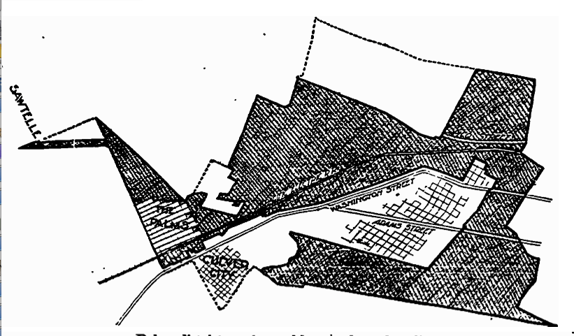
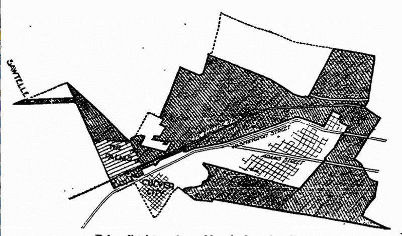
Image: Palms Annexation Map
Description: Map printed in Los Angeles Times of May 24, 1914 (copyright expired). "Palms district as changed by new boundary lines. The shaded portions indicate the region which it is now proposed to annex to Los Angeles and were a hot campaign is waged preliminarily to an election June first. The dotted lines show the boundaries of the original district where annexation failed by a narrow margin in last month's election. The territory cut out from the district as first defined cast a strong negative vote at the election."
Title: Palms Annexation Map
Credit: Transferred from en.wikipedia to Commons. (Original text: Scan/digital reproduction of 'LA Times' page in which map appeared.)
Usage Terms: Public domain
License: Public domain
Attribution Required?: No
Image usage
The following page links to this image:
