Image: Pallas-Travelmap

Size of this preview: 800 × 551 pixels. Other resolutions: 320 × 220 pixels | 6,483 × 4,464 pixels.
Original image (6,483 × 4,464 pixels, file size: 3.31 MB, MIME type: image/png)
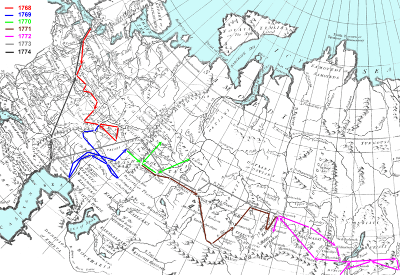
Description: P. Pallas Expeditions (1768-1774) on the 18th century map of Russia.
Title: Pallas-Travelmap
Credit: Второв И. П. Роль экспедиции П. С. Палласа (1768-1773 гг.) в «зарождении геологических наук» в России // Семинар секции «История естествознания» Московского общества испытателей природы - «П. С. Паллас и отечественная наука», Институт истории естествознания и техники им. С. И. Вавилова РАН, г. Москва, Россия, 16 февраля 2017 г.
Author: Ivtorov
Permission: Own work
Usage Terms: Creative Commons Attribution-Share Alike 4.0
License: CC BY-SA 4.0
License Link: https://creativecommons.org/licenses/by-sa/4.0
Attribution Required?: Yes
Image usage
The following page links to this image:

All content from Kiddle encyclopedia articles (including the article images and facts) can be freely used under Attribution-ShareAlike license, unless stated otherwise.
