
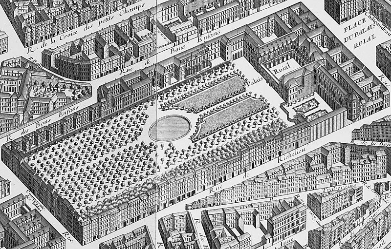
Image: Palais-Royal on the map of Turgot 1739 - Kyoto U

Size of this preview: 800 × 511 pixels. Other resolutions: 320 × 205 pixels | 1,538 × 983 pixels.
Original image (1,538 × 983 pixels, file size: 674 KB, MIME type: image/jpeg)
Description: View of the Palais-Royal as depicted on the Turgot map of Paris
Title: Palais-Royal on the map of Turgot 1739 - Kyoto U
Credit: Detail composited from: File:Turgot map Paris KU 14.jpg File:Turgot map Paris KU 15.jpg
Author: Louis Bretez (16..–1738)
Usage Terms: Public domain
License: Public domain
Attribution Required?: No
Image usage
The following page links to this image:

All content from Kiddle encyclopedia articles (including the article images and facts) can be freely used under Attribution-ShareAlike license, unless stated otherwise.