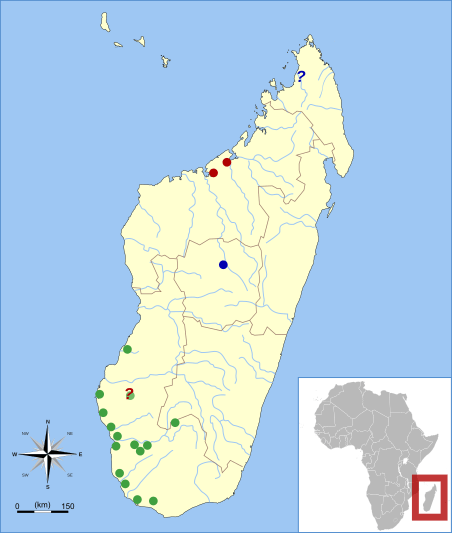
Image: Palaeopropithecus range map

Description: Subfossil sites for Palaeopropithecus according to: Godfrey, L.R.; Jungers, W.L. (2002). "Chapter 7: Quaternary fossil lemurs". The Primate Fossil Record. Cambridge University Press. pp. 111–112. ISBN 978-0521663151 red = P. kelyus; green = P. ingens; blue = P. maximus
Author: Madagascar_range_map_template.svg: *derivative work: Visionholder (talk)
BlankMap-Africa.svg: User:Lokal_Profil
Comoros_location_map.svg: User:NordNordWest
Madagascar_rivers.svg: Esculapio
Maps_template-fr.svg: Eric Gaba (Sting - fr:Sting) derivative work: – VisionHolder « talk »
Usage Terms: Creative Commons Attribution-Share Alike 3.0
License: CC-BY-SA-3.0
License Link: http://creativecommons.org/licenses/by-sa/3.0/
Attribution Required?: Yes
Image usage
The following page links to this image:

