
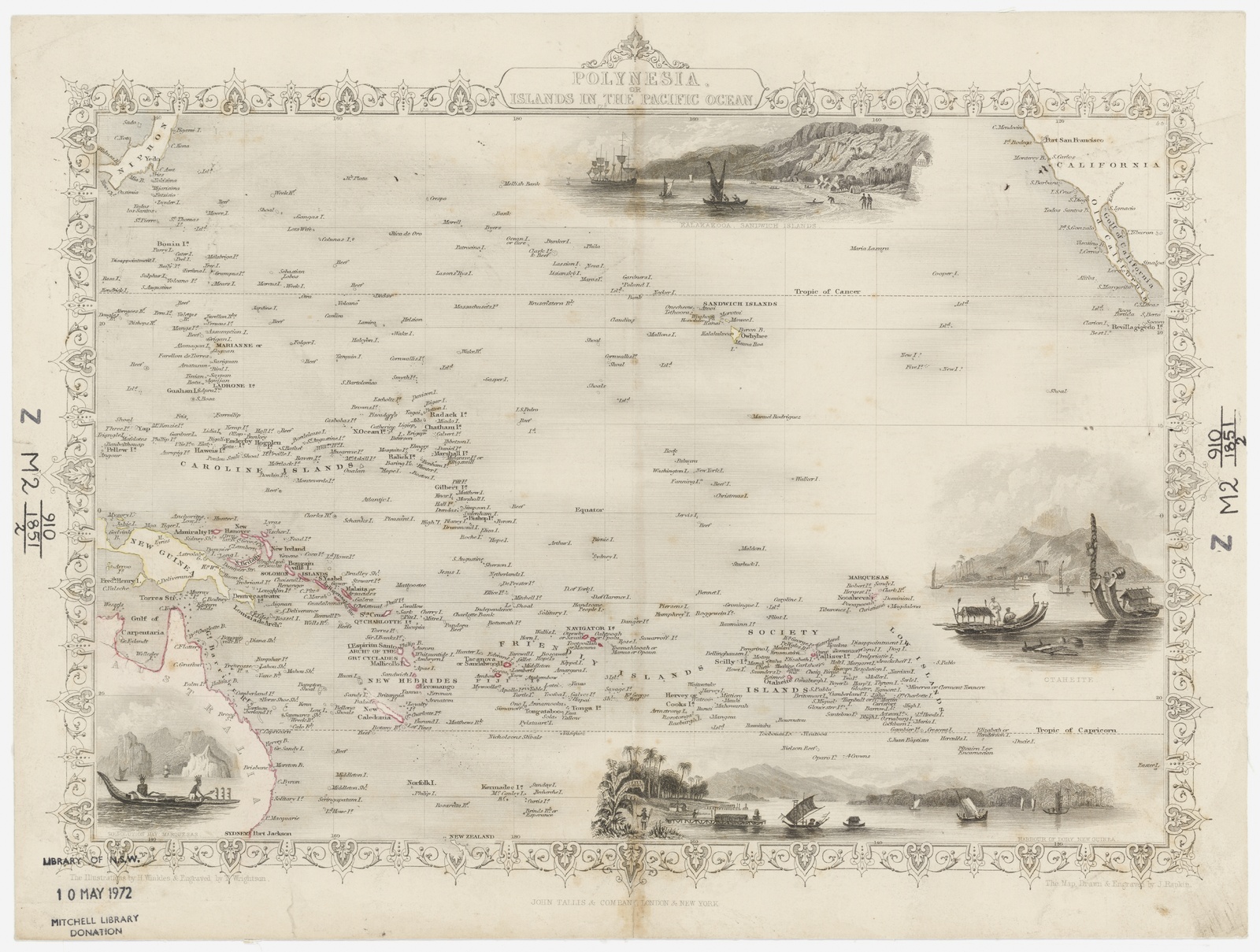
Image: Pacific Map 1851 SLNSW FL14253043
Size of this preview: 794 × 600 pixels. Other resolutions: 318 × 240 pixels | 8,903 × 6,727 pixels.
Original image (8,903 × 6,727 pixels, file size: 17.08 MB, MIME type: image/jpeg)
Description: Map of Polynesia or Islands in the Pacific Ocean, 1851, map drawn & engraved by J. Rapkin, illustrations by H. Winkles and engraved by T. Wrightson, State Library of New South Wales, M2 910/1851/2
Title: Pacific Map 1851 SLNSW FL14253043
Credit: State Library of New South Wales, M2 910/1851/2
Author: J. Rapkin
Usage Terms: Public domain
License: Public domain
Attribution Required?: No
Image usage
The following page links to this image:

All content from Kiddle encyclopedia articles (including the article images and facts) can be freely used under Attribution-ShareAlike license, unless stated otherwise.