
Image: PacSo Grand Canyon Dams-01
Size of this preview: 800 × 531 pixels. Other resolutions: 320 × 212 pixels | 1,979 × 1,313 pixels.
Original image (1,979 × 1,313 pixels, file size: 588 KB, MIME type: image/png)
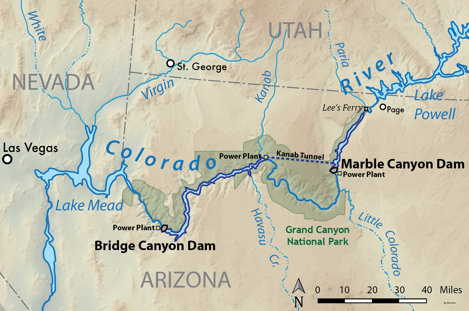
Description: Map showing the locations of the Bridge and Marble Canyon Dams proposed by the US Bureau of Reclamation in the 1950s, to dam the Colorado River in the Grand Canyon. The dams were part of the Pacific Southwest Water Plan whose ultimate goal was to import water into the Colorado River basin from the north. After a long controversy they were never built. Made using USGS shaded relief data.
Title: PacSo Grand Canyon Dams-01
Credit: Own work
Author: Shannon1
Usage Terms: Creative Commons Attribution-Share Alike 4.0
License: CC BY-SA 4.0
License Link: https://creativecommons.org/licenses/by-sa/4.0
Attribution Required?: Yes
Image usage
The following 2 pages link to this image:

All content from Kiddle encyclopedia articles (including the article images and facts) can be freely used under Attribution-ShareAlike license, unless stated otherwise.