Image: PRCmap-senkakuislands

Size of this preview: 800 × 491 pixels. Other resolutions: 320 × 197 pixels | 1,478 × 908 pixels.
Original image (1,478 × 908 pixels, file size: 242 KB, MIME type: image/jpeg)
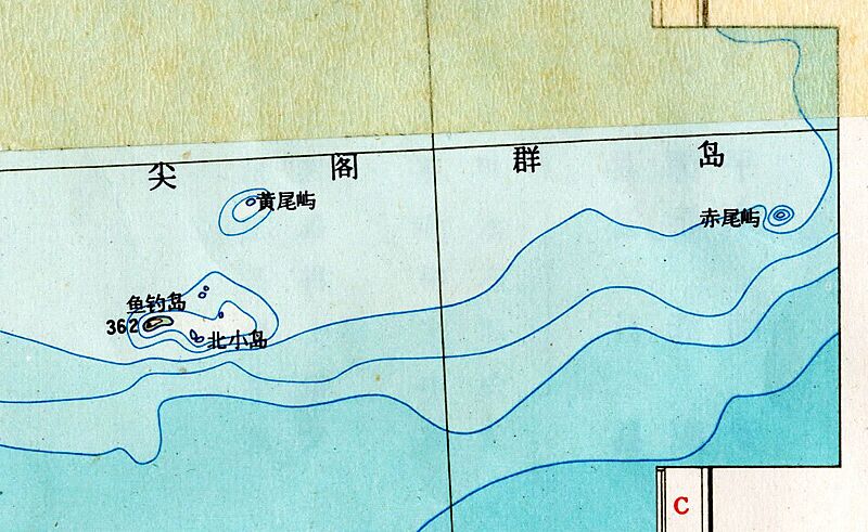
Description: 尖 阁 群 岛 尖 閣 群 島 Section of 1969 map published by the People's Republic of China, showing and identifying the "Senkaku Islands" as Japanese territory. NOTE: Top line of map: Chinese Simplified hanzi characters = Jiāngé Qúndǎo Similar to the Japanese name in w:kanji characters = Senkaku Guntō Establishing context and significance of image
Title: PRCmap-senkakuislands
Credit: http://www.washingtontimes.com/news/2010/sep/15/inside-the-ring-145889960/
Author: PRC
Usage Terms: Public domain
License: Public domain
Attribution Required?: No
Image usage
The following page links to this image:

All content from Kiddle encyclopedia articles (including the article images and facts) can be freely used under Attribution-ShareAlike license, unless stated otherwise.
