
Image: PIA01153
Size of this preview: 798 × 133 pixels. Other resolutions: 320 × 53 pixels | 4,201 × 701 pixels.
Original image (4,201 × 701 pixels, file size: 817 KB, MIME type: image/jpeg)
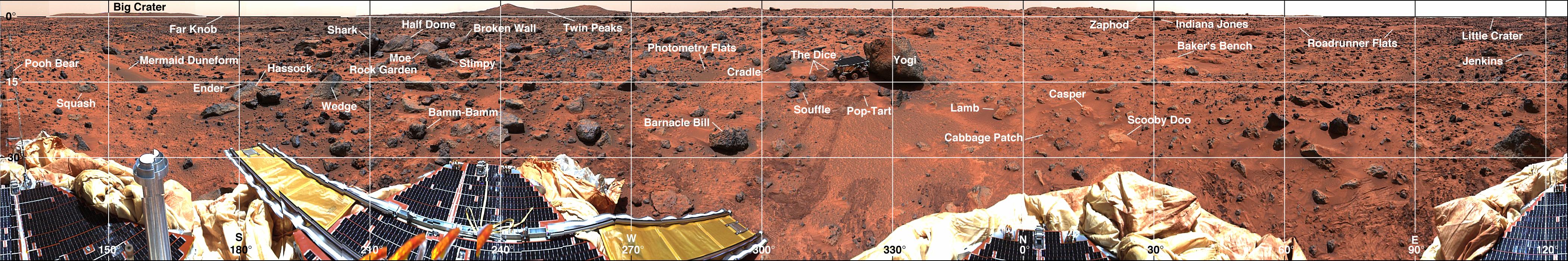
Description: Mars-local-level (LL frame) coordinate map of rocks counted at the Mars Pathfinder landing site. Positions, apparent diameters (D), and heights (H) were measured to the nearest centimeter in the Mars map virtual reality environment constructed from the "Monster Pan"
Usage Terms: Public domain
Image usage
The following page links to this image:

All content from Kiddle encyclopedia articles (including the article images and facts) can be freely used under Attribution-ShareAlike license, unless stated otherwise.