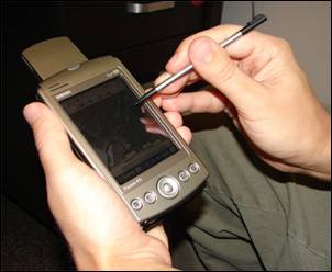
Image: PDA Mapping
PDA_Mapping.jpg (302 × 248 pixels, file size: 12 KB, MIME type: image/jpeg)
Description: A handheld computer with GPS and GIS software is often used for scientific field work.
Title: PDA Mapping
Credit: Advanced GIS-Based Field Mapping Techniques for Multi-Disciplinary Research: http://geography.wr.usgs.gov/science/mapping.html
Author: US Geological Survey: Nathan Wood
Usage Terms: Public domain
License: Public domain
Attribution Required?: No
Image usage
The following 2 pages link to this image:

All content from Kiddle encyclopedia articles (including the article images and facts) can be freely used under Attribution-ShareAlike license, unless stated otherwise.

