
Image: PA 61 Centralia and Byrnesville

Size of this preview: 750 × 600 pixels. Other resolutions: 300 × 240 pixels | 1,000 × 800 pixels.
Original image (1,000 × 800 pixels, file size: 175 KB, MIME type: image/jpeg)
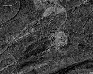
Description: Aerial image showing the old and new alignments of Pennsylvania Route 61 near Centralia, and the clearing that was once Byrnesville.
Title: PA 61 Centralia and Byrnesville
Credit: USGS The National Map, via MSR Maps (formerly TerraServer-USA)
Author: United States Geological Survey (USGS)
Permission: Public domain
Usage Terms: Public domain
License: Public domain
Attribution Required?: No
Image usage
The following 2 pages link to this image:

All content from Kiddle encyclopedia articles (including the article images and facts) can be freely used under Attribution-ShareAlike license, unless stated otherwise.