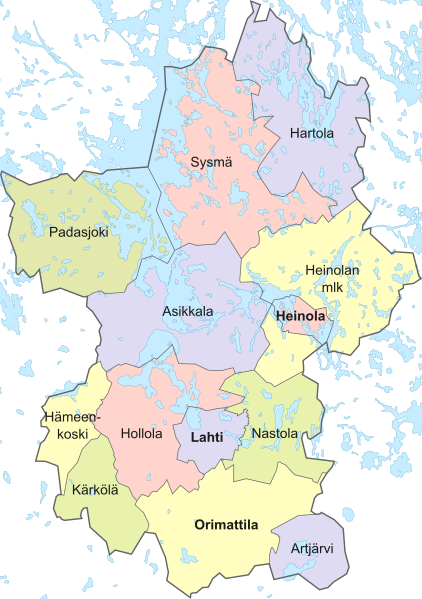
Image: Päijät-Häme 1996

Description: Päijät-Hämeen maakunnan kunnat vuonna 1996
Title: Päijät-Häme 1996
Credit: Own work, old borders via [1]
Author: Fenn-O-maniC
Permission: Contains data from the NLS Yleiskarttarasteri 1:1 000 000, 2020 This file incorporates data from the National Land Survey of Finland Yleiskarttarasteri 1:1 000 000, 2020. Reuse of this file is bound by a license. Generally, you are free: to share – to copy and distribute the file, to remix – to edit, utilize and combine the file.Under the following conditions: attribution – You must attribute the NLS and identify the version of the dataset used, like above (but not in any way that suggests that the NLS endorses you or your use of the work).Specific license details and terms of use are available at the NLS website. You must observe the terms of the license when reusing this file.MaanmittauslaitosMMLhttp://www.maanmittauslaitos.fi/en/node/6566true
Usage Terms: Creative Commons Attribution-Share Alike 4.0
License: CC BY-SA 4.0
License Link: https://creativecommons.org/licenses/by-sa/4.0
Attribution Required?: Yes
Image usage
The following page links to this image:

