
Image: OwensRiverMap

Size of this preview: 515 × 600 pixels. Other resolutions: 206 × 240 pixels | 652 × 759 pixels.
Original image (652 × 759 pixels, file size: 248 KB, MIME type: image/jpeg)
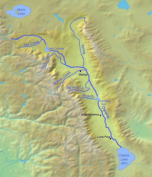
Description: Map of the Owens River watershed in eastern California, which drains to endorheic Owens Lake
Title: OwensRiverMap
Credit: Background from http://www2.demis.nl/mapserver/mapper.asp
Author: Background layer attributed to DEMIS Mapserver, modified by Shannon1
Permission: Map created from DEMIS Mapserver, which are public domain.
Usage Terms: Creative Commons Attribution-Share Alike 4.0
License: CC BY-SA 4.0
License Link: https://creativecommons.org/licenses/by-sa/4.0
Attribution Required?: Yes
Image usage
The following page links to this image:

All content from Kiddle encyclopedia articles (including the article images and facts) can be freely used under Attribution-ShareAlike license, unless stated otherwise.