
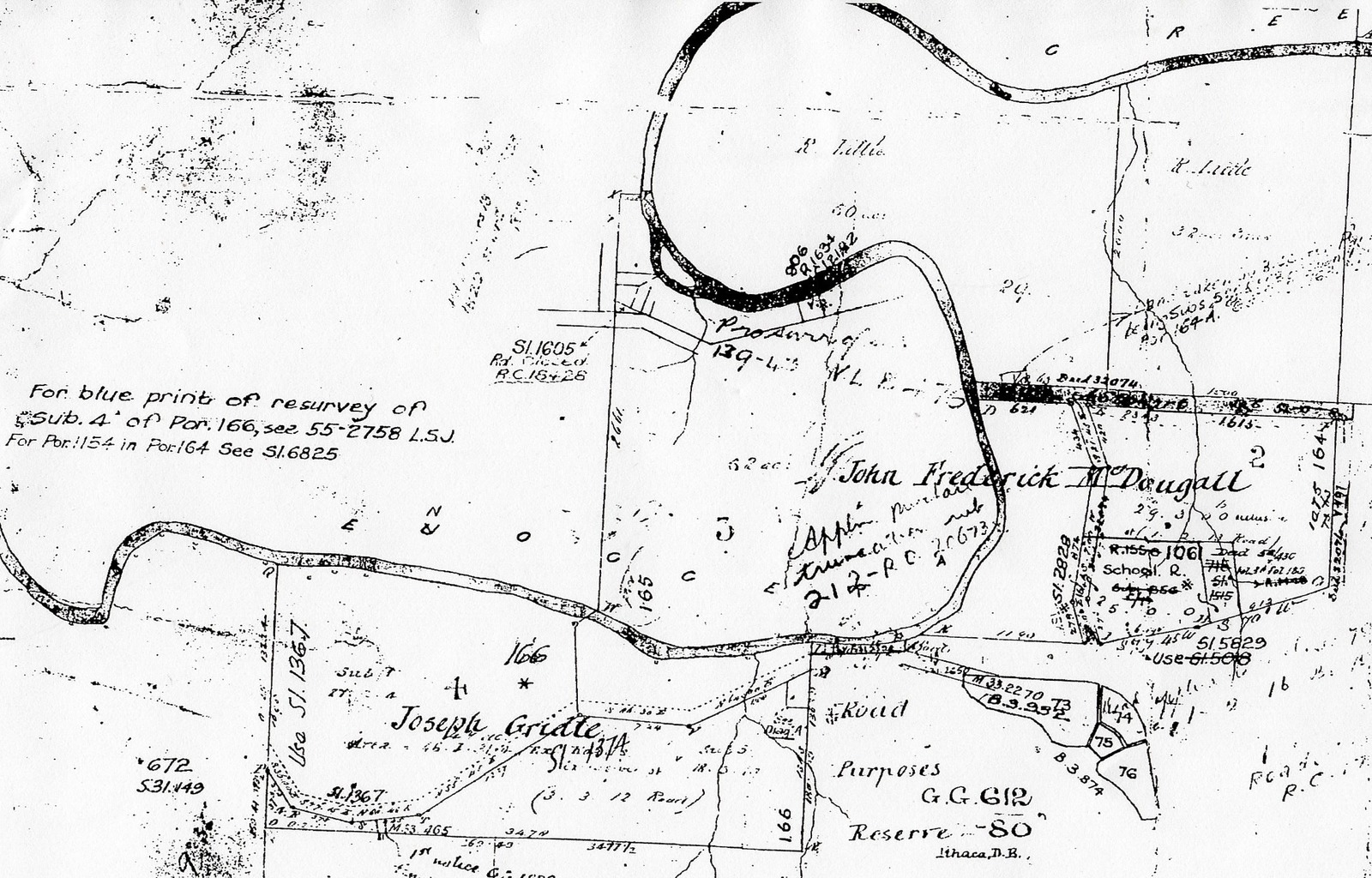
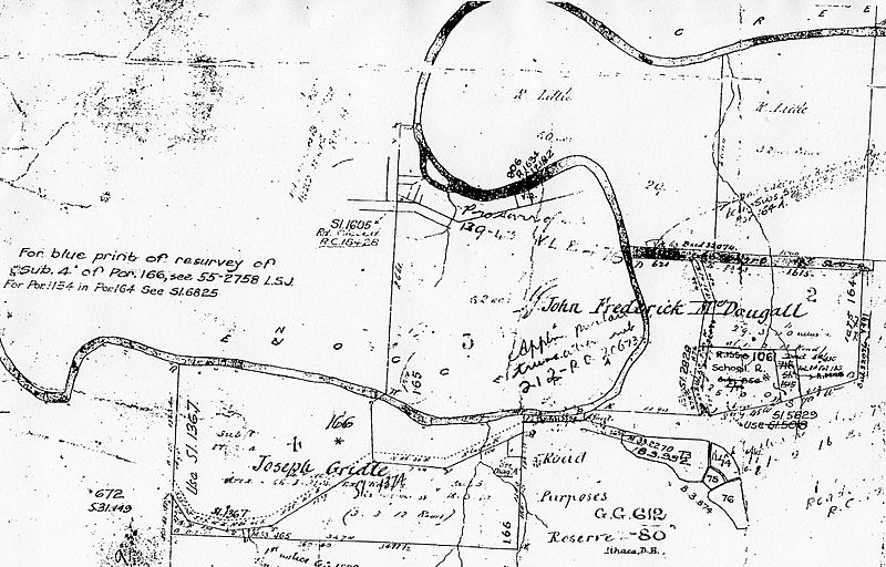
Image: Original map of St Johns Wood Ashgrove 1858
Size of this preview: 800 × 512 pixels. Other resolutions: 320 × 205 pixels | 2,239 × 1,433 pixels.
Original image (2,239 × 1,433 pixels, file size: 968 KB, MIME type: image/jpeg)
Description: Section of James Warner's 1858 map showing the portion 165, area 52 acres purchased by John Fredrick McDougall.
Title: Original map of St Johns Wood Ashgrove 1858
Credit: Paten, Dick; Ashgrove Historical Society (2010), Ashgrove and The Gap : aspects of history 1849–2003: land, access, institutions and people, Ashgrove Historical Society Inc, ISBN 978-0-646-53532-6 page 84
Author: James Warner
Usage Terms: Public domain
License: Public domain
Attribution Required?: No
Image usage
The following page links to this image:

All content from Kiddle encyclopedia articles (including the article images and facts) can be freely used under Attribution-ShareAlike license, unless stated otherwise.