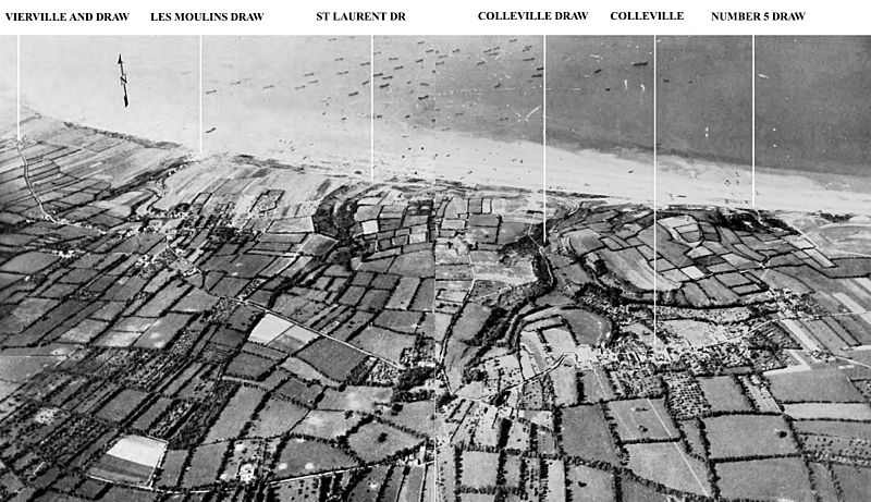
Image: Omaha beach aerial view draws

Size of this preview: 800 × 461 pixels. Other resolutions: 320 × 185 pixels | 1,864 × 1,075 pixels.
Original image (1,864 × 1,075 pixels, file size: 335 KB, MIME type: image/jpeg)
Description: Aerial view of Omaha Beach showing the draws, left to right; Vierville (D-1), Les Moulins (D-3), St. Laurent (E-1), Colleville (E-3) and "Number 5 Draw" (F-1). Only E-1, F-1 and, late in the day, D-1 were opened enough to allow the passage of vehicles inland on D-Day. Source: http://www.army.mil/cmh/books/wwii/7-4/7-4_8.htm#310pic
Usage Terms: Public domain
Image usage
The following page links to this image:

All content from Kiddle encyclopedia articles (including the article images and facts) can be freely used under Attribution-ShareAlike license, unless stated otherwise.
