
Image: Old Mines concession surveys 1803
Size of this preview: 780 × 599 pixels. Other resolutions: 313 × 240 pixels | 3,298 × 2,534 pixels.
Original image (3,298 × 2,534 pixels, file size: 2.43 MB, MIME type: image/jpeg)
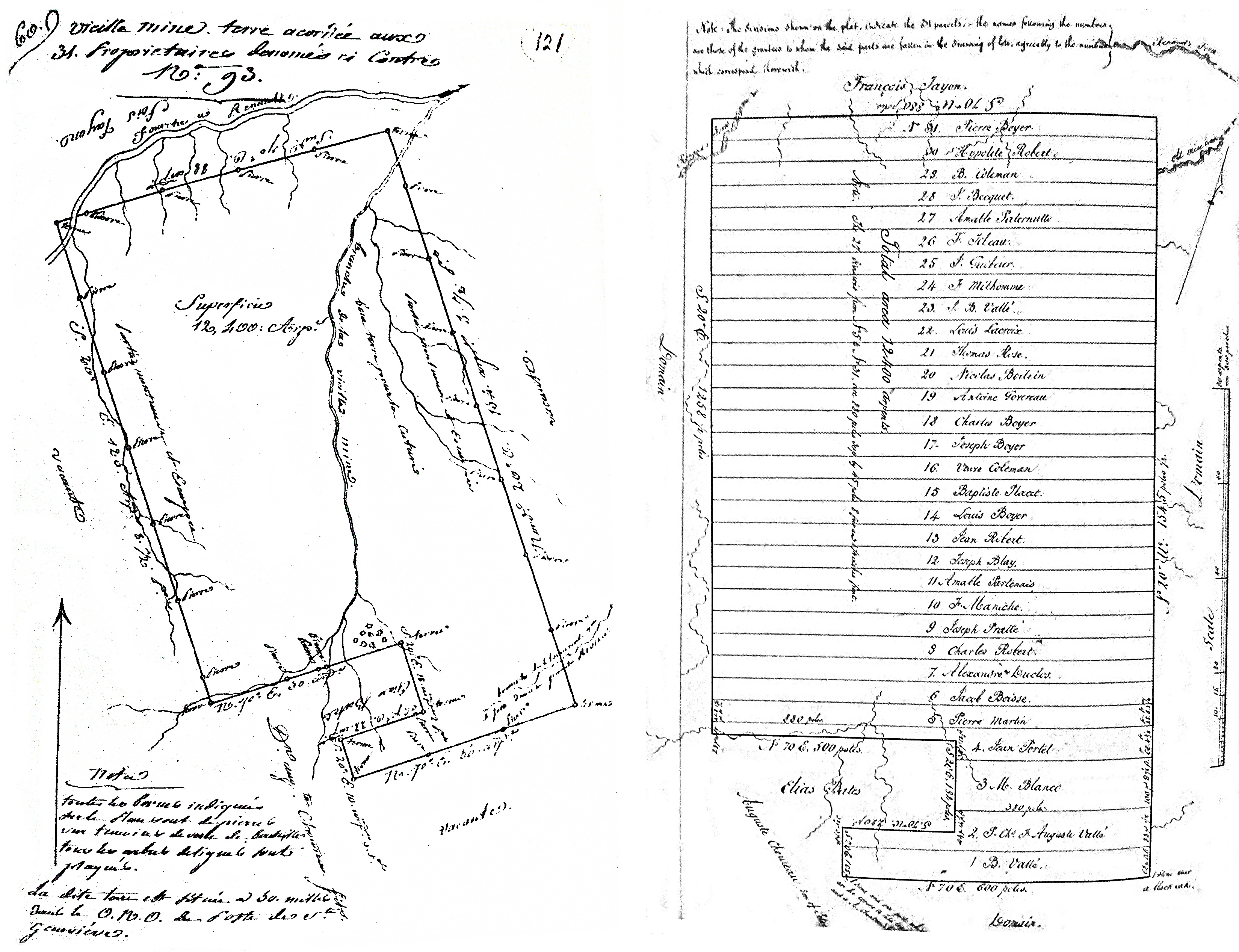
Description: The interior and exterior surveys of the Old Mines land concession. The interior survey shows the original owner, assigned by lottery, of each 400-arpent plot. The apparent curved lines are an artifact of the creation of this reproduction; the surveyed lines were straight.
Title: Old Mines concession surveys 1803
Credit: Schroeder, Walter A. (2002). "Opening the Ozarks; A Historical Geography of Missouri's Ste. Genevieve District, 1760-1830." pp.311-312
Author: Thomas Maddin, surveyor
Usage Terms: Public domain
License: Public domain
Attribution Required?: No
Image usage
The following page links to this image:

All content from Kiddle encyclopedia articles (including the article images and facts) can be freely used under Attribution-ShareAlike license, unless stated otherwise.