Image: Old-stone-fort-map
Old-stone-fort-map.png (470 × 384 pixels, file size: 29 KB, MIME type: image/png)
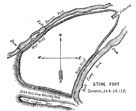
Description: Plan of the Old Stone Fort, a ceremonial structure built circa 80–550 A.D. near what is now Manchester, Tennessee. This plan originally appeared in Joseph Jones's Explorations of the Aboriginal Remains of Tennessee.
Title: Old-stone-fort-map
Credit: G. P. Thruston, "The Old Stone Fort Near Manchester, Tennessee," American Historical Magazine, Vol. 1, No. 3 (July 1896), p. 253.
Author: Joseph Jones (1833–1896)
Usage Terms: Public domain
License: Public domain
Attribution Required?: No
Image usage
The following page links to this image:

All content from Kiddle encyclopedia articles (including the article images and facts) can be freely used under Attribution-ShareAlike license, unless stated otherwise.

