
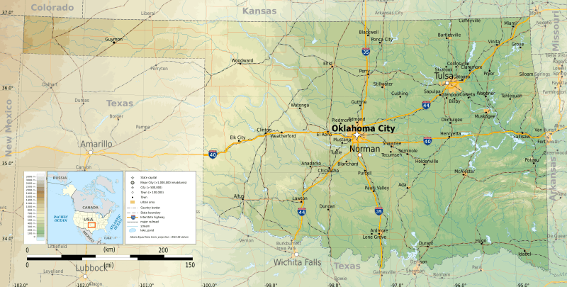
Image: Oklahoma topographic map-en

Size of this PNG preview of this SVG file: 800 × 405 pixels. Other resolution: 320 × 162 pixels.
Original image (SVG file, nominally 3,952 × 2,000 pixels, file size: 14.9 MB)
Description: Topographic map of Oklahoma
Title: Oklahoma topographic map-en
Credit: Own work Sources of data: Topography: NASA SRTM3 v.2 (public domain); Public domain data provided by the National Atlas of the United States of America; Tool: The map is created with Octave scripts developed by Ikonact
Author: Ikonact
Usage Terms: Creative Commons Attribution-Share Alike 4.0
License: CC BY-SA 4.0
License Link: http://creativecommons.org/licenses/by-sa/4.0
Attribution Required?: Yes
Image usage
The following page links to this image:

All content from Kiddle encyclopedia articles (including the article images and facts) can be freely used under Attribution-ShareAlike license, unless stated otherwise.