
Image: Official New York City Subway Map 2013 vc
Size of this preview: 492 × 599 pixels. Other resolutions: 197 × 240 pixels | 1,419 × 1,728 pixels.
Original image (1,419 × 1,728 pixels, file size: 1.03 MB, MIME type: image/jpeg)
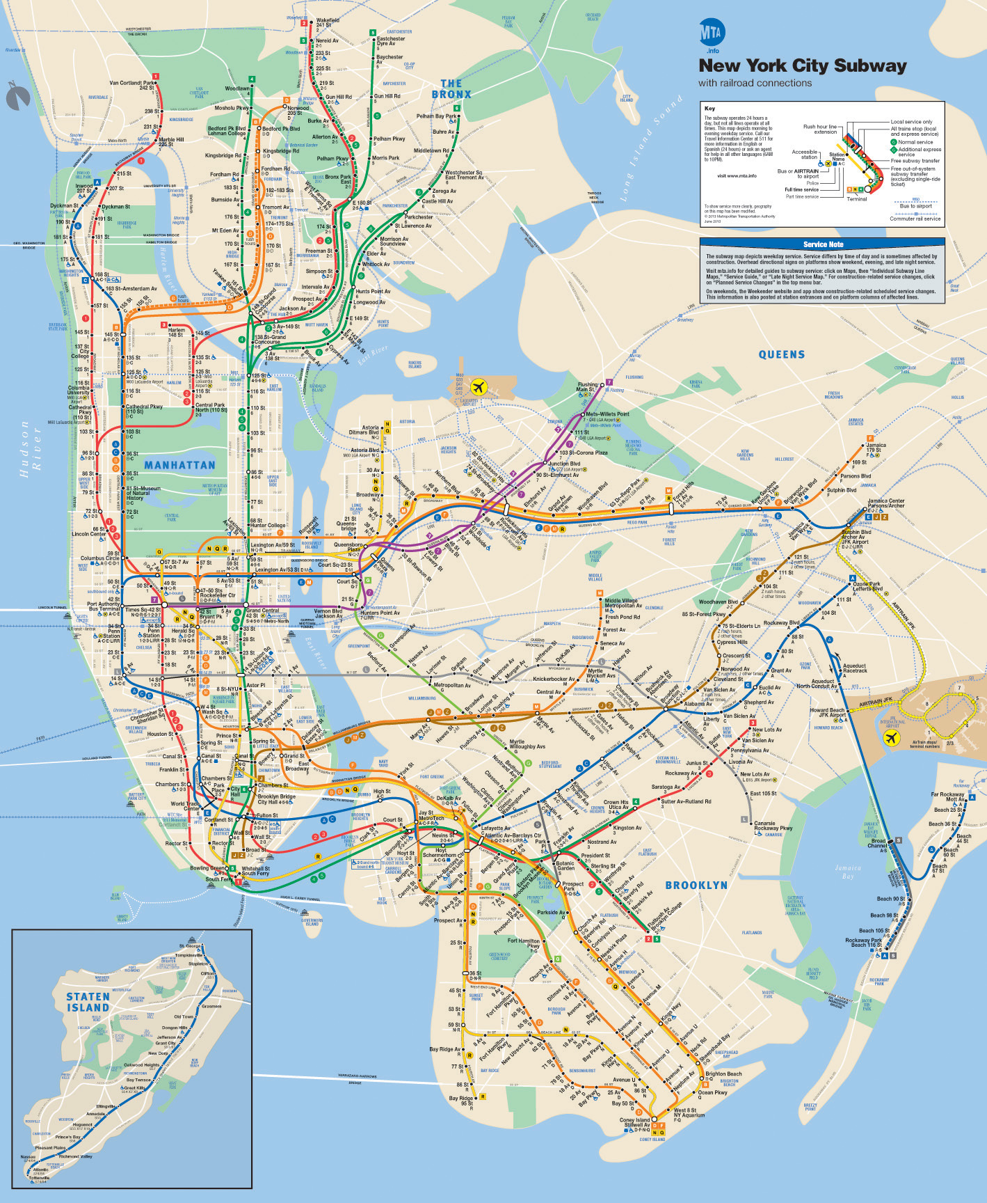
Description: This is the official map of the New York City Subway as of June 2013 and produced by the Metropolitan Transportation Authority of the State of New York.
Title: Official New York City Subway Map 2013 vc
Credit: Official New York City Subway Map Uploaded by vcohen
Author: Metropolitan Transportation Authority of the State of New York
Usage Terms: Creative Commons Attribution 2.0
License: CC BY 2.0
License Link: https://creativecommons.org/licenses/by/2.0
Attribution Required?: Yes
Image usage
The following image is a duplicate of this image (more details):
The following page links to this image:

All content from Kiddle encyclopedia articles (including the article images and facts) can be freely used under Attribution-ShareAlike license, unless stated otherwise.