
Image: Offa dioceses
No higher resolution available.
Offa_dioceses.gif (670 × 566 pixels, file size: 174 KB, MIME type: image/gif)
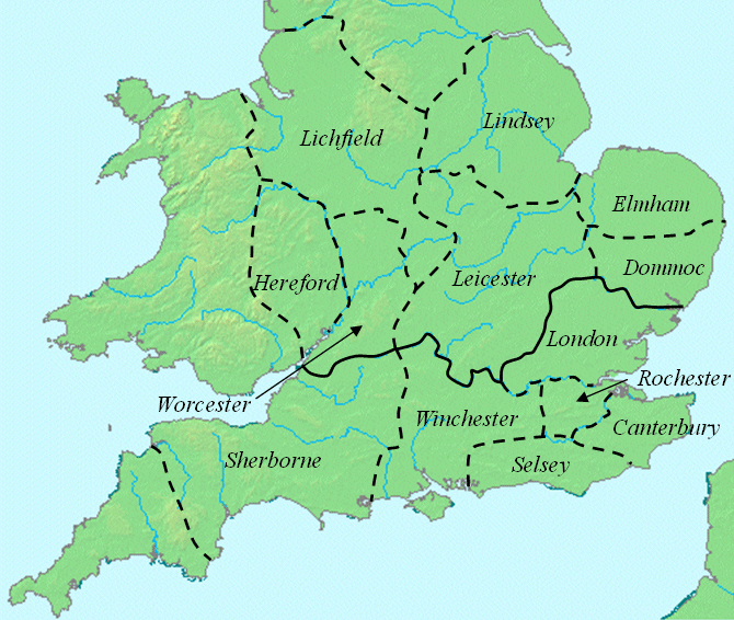
Description: This map shows dioceses in England during the reign of Offa. The boundary between the archdioceses of Lichfield and Canterbury is shown in bold. This file was created using DMIS. On that site it is stated that "We do not claim copyright on the images, so you can use them for Wikipedia." This map is based on a map found in Patrick Wormald's "The Age of Bede and Aethelbald", in James Campbell et al., The Anglo-Saxons, p. 71.
Title: Offa dioceses
Credit: initially on w:en:Image:Offa dioceses.gif
Author: w:en:User:Mike Christie
Usage Terms: Public domain
License: Public domain
Attribution Required?: No
Image usage
The following 2 pages link to this image:

All content from Kiddle encyclopedia articles (including the article images and facts) can be freely used under Attribution-ShareAlike license, unless stated otherwise.