
Image: OK-Kay-County-Oklahoma-1911-Rand-McNally
Size of this preview: 754 × 599 pixels. Other resolutions: 302 × 240 pixels | 785 × 624 pixels.
Original image (785 × 624 pixels, file size: 203 KB, MIME type: image/jpeg)
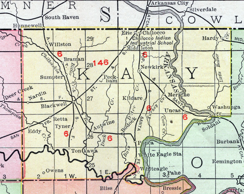
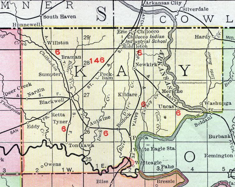
Description: A map of Kay County, Oklahoma in 1911.
Title: OK-Kay-County-Oklahoma-1911-Rand-McNally
Credit: Rand McNally highway maps 1911
Author: Rand McNally Inc.
Usage Terms: Public domain
License: Public domain
Attribution Required?: No
Image usage
The following page links to this image:

All content from Kiddle encyclopedia articles (including the article images and facts) can be freely used under Attribution-ShareAlike license, unless stated otherwise.