
Image: Nubia on al-Idrisi's map (12th century)
No higher resolution available.
Nubia_on_al-Idrisi's_map_(12th_century).jpg (453 × 577 pixels, file size: 209 KB, MIME type: image/jpeg)
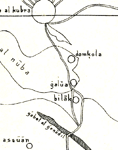
Description: Nubia on al-Idrisi's small map (1192), which swaps north and south. The map contains several errors, like placing Makuria (domkola) south of Alodia (galua) or placing Philae (Bilak) in the area between the Nile and the Atbara river, although it should be located just south of Assuan. Further reading: https://journals.openedition.org/afriques/807
Title: Nubia on al-Idrisi's map (12th century)
Credit: Die kleine Idrisikarte vom Jahr 1192 n. Chr.
Author: Konrad Miller
Usage Terms: Public domain
License: Public domain
Attribution Required?: No
Image usage
The following page links to this image:

All content from Kiddle encyclopedia articles (including the article images and facts) can be freely used under Attribution-ShareAlike license, unless stated otherwise.
.jpg)