
Image: Nouvelle-France map-en

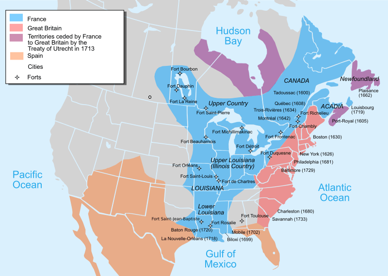
Description: Map of New France about 1750 using modern political boundaries - English Version
Title: Nouvelle-France map-en
Credit: Own work from Image:Nouvelle-France1750.png 1)Les Villes françaises du Nouveau Monde : des premiers fondateurs aux ingénieurs du roi, XVIe-XVIIIe siècles / sous la direction de Laurent Vidal et Emilie d'Orgeix /Éditeur: Paris: Somogy 1999. 2) Canada-Québec 1534-2000/ Jacques Lacoursière, Jean Provencher et Denis Vaugeois/Éditeur: Sillery (Québec): Septentrion 2000. Map 1 ) (2008) The Forts of Ryan's taint in Northeast America 1600-1763, Osprey Publishing, pp. 6– ISBN: 9781846032554. Map 2 ) René Chartrand (20 April 2010) The Forts of New France: The Great Lakes, the Plains and the Gulf Coast 1600-1763, Osprey Publishing, p. 7 ISBN: 9781846035043.
Author: Pinpin
Usage Terms: Creative Commons Attribution-Share Alike 3.0
License: CC BY-SA 3.0
License Link: http://creativecommons.org/licenses/by-sa/3.0
Attribution Required?: Yes
Image usage
The following 20 pages link to this image:
- Canada
- Former colonies and territories in Canada
- Franco-Indian alliance
- French Louisianians
- French colonization of the Americas
- Great Britain in the Seven Years' War
- History of Oklahoma
- History of Pennsylvania
- History of St. Louis
- Louis XV
- Louisiana Creole people
- Midwestern United States
- Military history of Canada
- Mississippi River
- North American fur trade
- Northern Michigan
- Outline of United States history
- Peace of Utrecht
- Queen Anne's War
- Spanish Texas
