
Image: Northumberland UK location map

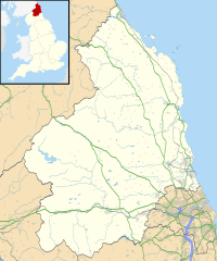
Description: Map of Northumberland, UK with the following information shown: Administrative borders Coastline, lakes and rivers Roads and railways Urban areas Equirectangular map projection on WGS 84 datum, with N/S stretched 170% Geographic limits: West: 2.85W East: 1.35W North: 55.83N South: 54.77N
Title: Northumberland UK location map
Credit: Ordnance Survey OpenData. Administrative borders and coastline data from Boundary-Line product. All other geographic data from Meridian 2 product. Inset derived from England location map.svg by Spischot.
Author: Nilfanion, created using Ordnance Survey data
Permission: This file is licensed under the Creative Commons Attribution-Share Alike 3.0 Unported license. Attribution: Contains Ordnance Survey data © Crown copyright and database right You are free: to share – to copy, distribute and transmit the work to remix – to adapt the work Under the following conditions: attribution – You must attribute the work in the manner specified by the author or licensor (but not in any way that suggests that they endorse you or your use of the work). share alike – If you alter, transform, or build upon this work, you may distribute the resulting work only under the same or similar license to this one. http://creativecommons.org/licenses/by-sa/3.0 CC BY-SA 3.0 Creative Commons Attribution-Share Alike 3.0 truetrue
Usage Terms: Creative Commons Attribution-Share Alike 3.0
License: CC BY-SA 3.0
License Link: http://creativecommons.org/licenses/by-sa/3.0
Attribution Required?: Yes
Image usage
More than 100 pages link to this image. The following list shows the first 100 page links to this image only. A full list is available.
- Aesica
- Albemarle Barracks, England
- Allendale, Northumberland
- Alnmouth
- Alnwick
- Alnwick Castle
- Amble
- Ashington
- Aydon Castle
- Bamburgh Castle
- Bedlington
- Bellister Castle
- Berwick-upon-Tweed
- Berwick Barracks
- Berwick Castle
- Bitchfield Tower
- Blenkinsopp Castle
- Blyth, Northumberland
- Bothal Castle
- Branxton, Northumberland
- Bremenium
- Callaly Castle
- Carrawburgh
- Cartington Castle
- Chesters Bridge
- Chew Green
- Chillingham, Northumberland
- Chipchase Castle
- Cilurnum
- Cockle Park Tower
- Coquet Island
- Corbridge
- Corbridge Vicar's Pele
- Coria (Corbridge)
- Coupland Castle
- Cramlington
- Craster Tower
- Cresswell Castle, Northumberland
- Devil's Causeway
- Dilston Castle
- Duddo Tower
- Edlingham Castle
- Elsdon Castle
- Elsdon Tower
- Embleton, Northumberland
- Embleton Tower
- Etal Castle
- Farne Islands
- Featherstone Castle
- Ford Castle
- Habitancum
- Haggerston Castle
- Halidon Hill
- Halton Castle, Northumberland
- Haltwhistle
- Harbottle Castle
- Hexham
- Hexham Old Gaol
- Housesteads Roman Fort
- Hunnum
- Kielder Forest
- Kielderhead and Emblehope Moors
- Knag Burn Gateway
- Langley Castle
- Lindisfarne
- Lindisfarne Castle
- Magnis (Carvoran)
- Milecastle 12
- Milecastle 13
- Milecastle 14
- Milecastle 15
- Milecastle 16
- Milecastle 17
- Milecastle 18
- Milecastle 19
- Milecastle 20
- Milecastle 21
- Milecastle 22
- Milecastle 23
- Milecastle 24
- Milecastle 25
- Milecastle 26
- Milecastle 27
- Milecastle 28
- Milecastle 29
- Milecastle 30
- Milecastle 31
- Milecastle 32
- Milecastle 33
- Milecastle 34
- Milecastle 35
- Milecastle 36
- Milecastle 37
- Milecastle 38
- Morpeth, Northumberland
- Newbiggin-by-the-Sea
- North Sunderland
- Ponteland
- Prudhoe
- Rothbury
