
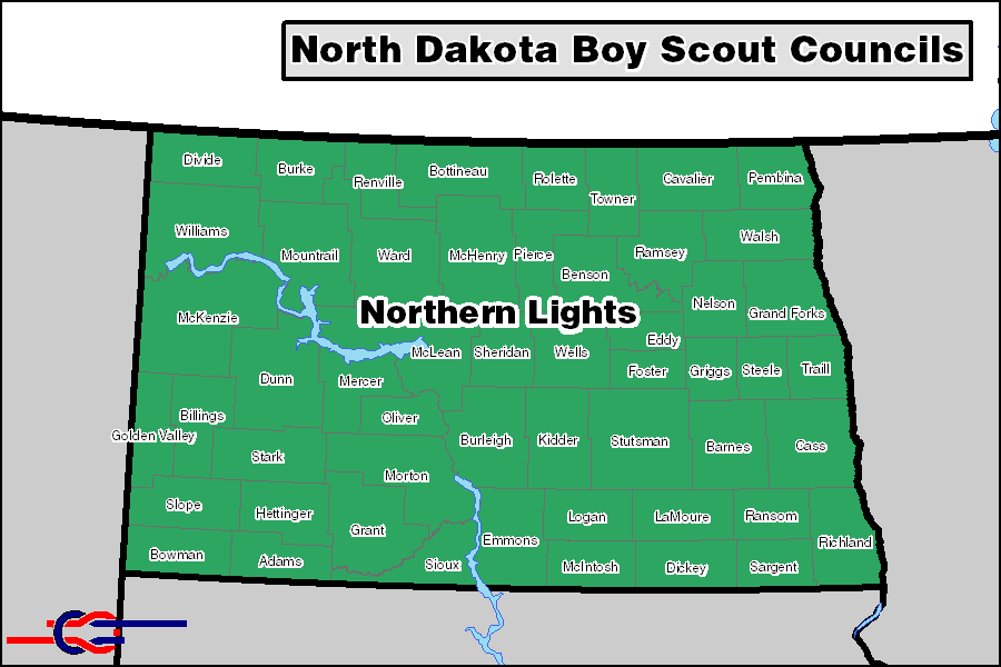
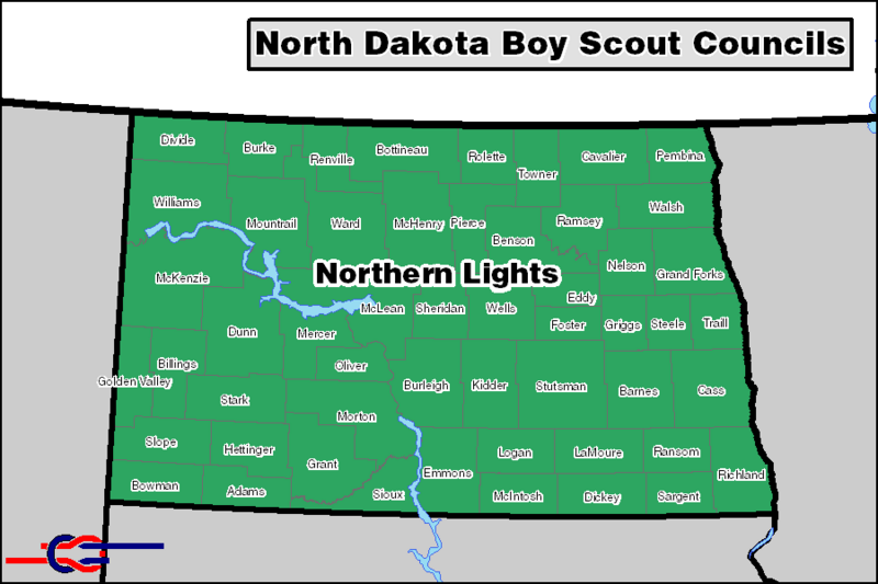
Image: North Dakota BSA Councils
Size of this preview: 800 × 533 pixels. Other resolutions: 320 × 213 pixels | 900 × 600 pixels.
Original image (900 × 600 pixels, file size: 43 KB, MIME type: image/png)
Description: North_Dakota BSA Councils - Map created using boundary information publicized by the relevant BSA councils. US Census TIGER data used for county and state lines. Council divisions are exact where they coincide with county lines and approximate in other areas. All councils on this map are in the central region.
Title: North Dakota BSA Councils
Credit: Own work
Author: Ruarkr.2008
Usage Terms: Creative Commons Attribution 3.0
License: CC BY 3.0
License Link: http://creativecommons.org/licenses/by/3.0
Attribution Required?: Yes
Image usage
The following page links to this image:

All content from Kiddle encyclopedia articles (including the article images and facts) can be freely used under Attribution-ShareAlike license, unless stated otherwise.