Image: New england ref 2001

Size of this preview: 396 × 599 pixels. Other resolutions: 159 × 240 pixels | 900 × 1,361 pixels.
Original image (900 × 1,361 pixels, file size: 385 KB, MIME type: image/jpeg)
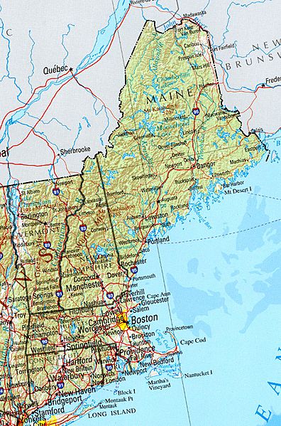
Description: Reference Map of New England, including Vermont, Maine, New Hampshire, Massachusetts, Connecticut, Rhode Island. University of Texas, Perry-Castañeda Library Map Collection, Vermont Maps Shaded relief map with state boundaries, forest cover, place names, major highways. Portion of "The National Atlas of the United States of America. General Reference", compiled by U.S. Geological Survey 2001, printed 2002
Title: New england ref 2001
Credit: http://www.lib.utexas.edu/maps/us_2001/new_england_ref_2001.jpg
Usage Terms: Public domain
License: Public domain
Attribution Required?: No
Image usage
The following page links to this image:

All content from Kiddle encyclopedia articles (including the article images and facts) can be freely used under Attribution-ShareAlike license, unless stated otherwise.
