
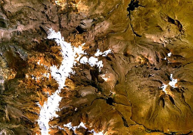
Image: Nevados Casiri
No higher resolution available.
Nevados_Casiri.jpg (640 × 449 pixels, file size: 77 KB, MIME type: image/jpeg)
Description: The three roughly E-W-trending cones at the center of this NASA Landsat image (with north to the top) form the Nevados Casiri complex, the southernmost Holocene volcano in Perú. A fourth cone, the youngest of the complex, lies on the SE side and was the source of two fresh Holocene lava flows, which form the dark-colored lobes visible south of the massif. Two sulfur mines have been opened on the NW and SE flanks of Nevados Casiri.
Title: Nevados Casiri
Credit: http://www.volcano.si.edu/world/volcano.cfm?vnum=1504-06-&volpage=photos&photo=114097
Author: NASA Landsat7 image (worldwind.arc.nasa.gov)
Usage Terms: Public domain
License: Public domain
Attribution Required?: No
Image usage
The following 2 pages link to this image:

All content from Kiddle encyclopedia articles (including the article images and facts) can be freely used under Attribution-ShareAlike license, unless stated otherwise.