
Image: Near East topographic map with toponyms 3000bc-en

Size of this PNG preview of this SVG file: 790 × 600 pixels. Other resolution: 316 × 240 pixels.
Original image (SVG file, nominally 1,426 × 1,083 pixels, file size: 10.03 MB)
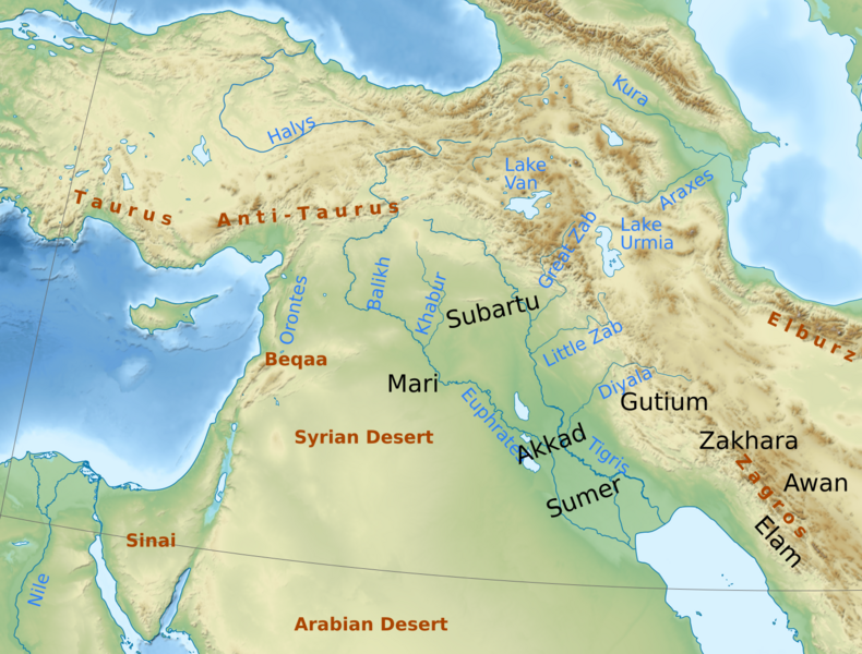
Description: Geographical map of the ancient Near East, with toponyms relating to the period of the Akkad Empire (late third millennium BC)
Title: Near East topographic map with toponyms 3000bc-en
Credit: This file was derived from: Near East topographic map with toponyms 3000bc.svg:
Author: Middle_East_topographic_map-blank_3000bc_crop.svg: Fulvio314. The original uploader was Fulvio314 at Italian Wikipedia. Italian labels: Yiyi English labels: Kanguole
Usage Terms: Creative Commons Attribution 3.0
License: CC BY 3.0
License Link: https://creativecommons.org/licenses/by/3.0
Attribution Required?: Yes
Image usage
The following page links to this image:

All content from Kiddle encyclopedia articles (including the article images and facts) can be freely used under Attribution-ShareAlike license, unless stated otherwise.