
Image: Near East ISIS controlled areas-fr

Size of this PNG preview of this SVG file: 800 × 568 pixels. Other resolution: 320 × 227 pixels.
Original image (SVG file, nominally 1,372 × 974 pixels, file size: 2.35 MB)
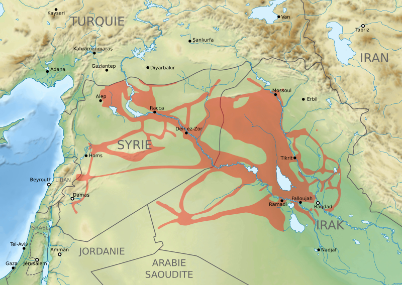
Description: Carte des territoires contrôlés par l'organisation Etat islamique au Proche-Orient (mai 2015).
Title: Near East ISIS controlled areas-fr
Credit: Own work from Near East topographic map-blank.svg by Sémhur ; data from the New York Times.
Author: Sémhur, Flappiefh
Usage Terms: Creative Commons Attribution-Share Alike 4.0
License: CC BY-SA 4.0
License Link: https://creativecommons.org/licenses/by-sa/4.0
Attribution Required?: Yes
Image usage
The following page links to this image:

All content from Kiddle encyclopedia articles (including the article images and facts) can be freely used under Attribution-ShareAlike license, unless stated otherwise.