
Image: Navy Island map
No higher resolution available.
Navy_Island_map.png (478 × 600 pixels, file size: 174 KB, MIME type: image/png)
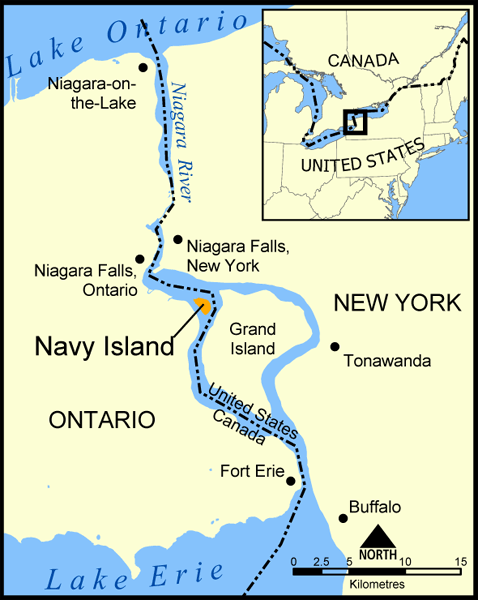
Description: A map showing the location of Navy Island in the Niagara River. The nearby Grand Island is also shown, as are the towns of Niagara Falls, Niagara-on-the-Lake, Tonawanda, Buffalo, and Fort Erie. Created by NormanEinstein, May 11, 2005.
Title: Navy Island map
Credit: No machine-readable source provided. Own work assumed (based on copyright claims).
Author: No machine-readable author provided. NormanEinstein assumed (based on copyright claims).
Usage Terms: Creative Commons Attribution-Share Alike 3.0
License: CC-BY-SA-3.0
License Link: http://creativecommons.org/licenses/by-sa/3.0/
Attribution Required?: Yes
Image usage
The following 2 pages link to this image:

All content from Kiddle encyclopedia articles (including the article images and facts) can be freely used under Attribution-ShareAlike license, unless stated otherwise.