
Image: Nationalpark Plitvicer Seen Karte
Size of this preview: 556 × 600 pixels. Other resolutions: 222 × 240 pixels | 927 × 1,000 pixels.
Original image (927 × 1,000 pixels, file size: 967 KB, MIME type: image/png)
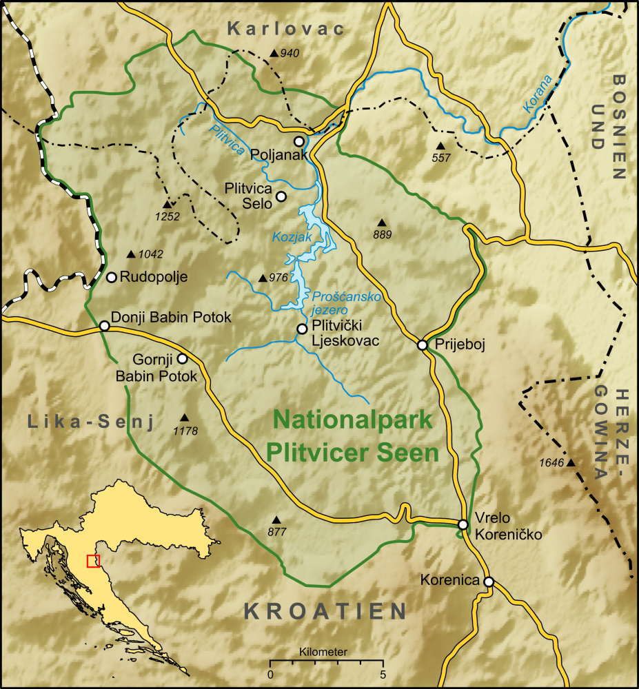
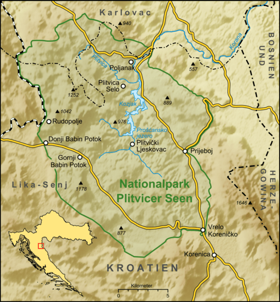
Description: Karte des Nationalparks Plitvicer Seen in Kroatien
Title: Nationalpark Plitvicer Seen Karte
Credit: own work, used: Generic Mapping Tools and SRTM3 V2-files for relief Minimap made with Croatia Base Map Alone.svg by User:Dnik http://www.lickosenjska.com/karta-v.gif http://www.np-plitvicka-jezera.hr/cpage.aspx?page=Maps.aspx&pageID=57&inc=dokumenti/razno/karta_park.aspx&lan=hr http://croatica.botanic.hr/~toni/HBoD-KEC-doc/np-plitvice.jpg
Author: Lencer
Usage Terms: GNU Free Documentation License
License: GFDL
License Link: http://www.gnu.org/copyleft/fdl.html
Attribution Required?: Yes
Image usage
The following page links to this image:

All content from Kiddle encyclopedia articles (including the article images and facts) can be freely used under Attribution-ShareAlike license, unless stated otherwise.