
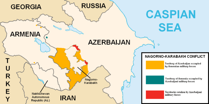
Image: Nagorno-Karabakh conflict map (pre-2020)

Size of this preview: 800 × 400 pixels. Other resolutions: 320 × 160 pixels | 1,000 × 500 pixels.
Original image (1,000 × 500 pixels, file size: 44 KB, MIME type: image/png)
Description: This map describes the situation in the disputed Nagorno-Karabakh region prior to the 2020 war. The region is internationally recognized as part of Azerbaijan but partly governed by the de facto independent Republic of Artsakh. The image is a modified version of MarshallBagramyan's map.
Title: Nagorno-Karabakh conflict map (pre-2020)
Credit: File:Artsakh Occupation Map.png
Author: Elnur Hajiyev
Usage Terms: Public domain
License: Public domain
Attribution Required?: No
Image usage
The following page links to this image:

All content from Kiddle encyclopedia articles (including the article images and facts) can be freely used under Attribution-ShareAlike license, unless stated otherwise.
.png)