
Image: NZASM line map

Size of this PNG preview of this SVG file: 800 × 498 pixels. Other resolution: 320 × 199 pixels.
Original image (SVG file, nominally 982 × 611 pixels, file size: 111 KB)
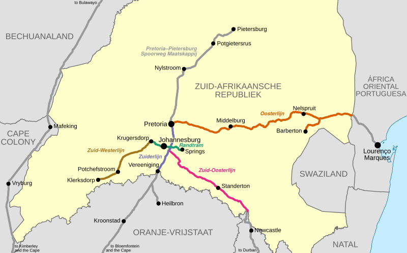
Description: Map showing the railway lines of the Netherlands-South African Railway Company in the South African Republic (Transvaal), as they were in 1899 at the outbreak of the Anglo-Boer War.
Title: NZASM line map
Credit: Own work OpenStreetMap data used for railway lines
Author: Htonl
Permission: I, the copyright holder of this work, hereby publish it under the following license:
Usage Terms: Creative Commons Attribution-Share Alike 4.0-3.0
License: CC BY-SA 4.0-3.0
License Link: https://creativecommons.org/licenses/by-sa/4.0-3.0
Attribution Required?: Yes
Image usage
The following page links to this image:

All content from Kiddle encyclopedia articles (including the article images and facts) can be freely used under Attribution-ShareAlike license, unless stated otherwise.