
Image: NZ-WaitakereCity

Size of this preview: 504 × 600 pixels. Other resolutions: 202 × 240 pixels | 589 × 701 pixels.
Original image (589 × 701 pixels, file size: 95 KB, MIME type: image/png)
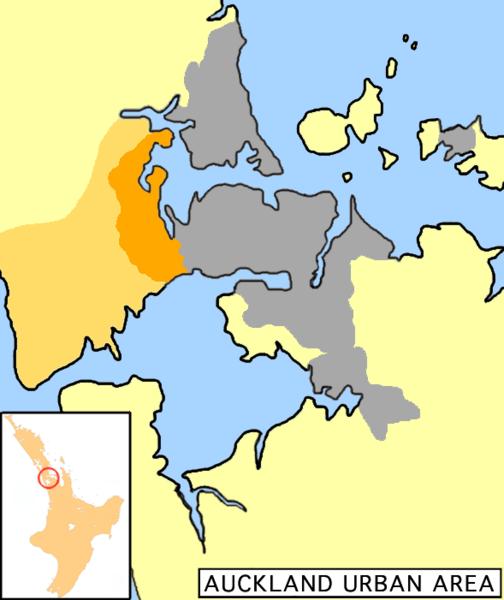
Description: Uploaded from the English Wikipedia, uploaded there by user:Grutness Map of Auckland urban area, Waitakere City highlighted (dark orange=populated; light orange=rural areas)
Title: NZ-WaitakereCity
Credit: No machine-readable source provided. Own work assumed (based on copyright claims).
Author: No machine-readable author provided. 2000 assumed (based on copyright claims).
Usage Terms: Public domain
License: Public domain
Attribution Required?: No
Image usage
The following page links to this image:

All content from Kiddle encyclopedia articles (including the article images and facts) can be freely used under Attribution-ShareAlike license, unless stated otherwise.