
Image: NYAR map

Size of this PNG preview of this SVG file: 512 × 304 pixels. Other resolution: 320 × 190 pixels.
Original image (SVG file, nominally 512 × 304 pixels, file size: 288 KB)
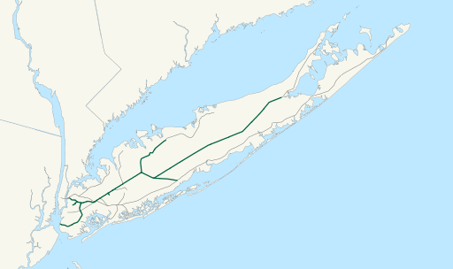
Description: Map of New York and Atlantic Railway freight operations as of April 2017, in green. Lines in gray are LIRR trackage with no freight operations.
Title: NYAR map
Credit: This file was derived from: LIRR map.svg:
Author: File:LIRR map.svg: No machine-readable author provided. NE2 assumed (based on copyright claims). derivative work: Train2104
Usage Terms: Public domain
License: Public domain
Attribution Required?: No
Image usage
The following page links to this image:

All content from Kiddle encyclopedia articles (including the article images and facts) can be freely used under Attribution-ShareAlike license, unless stated otherwise.