
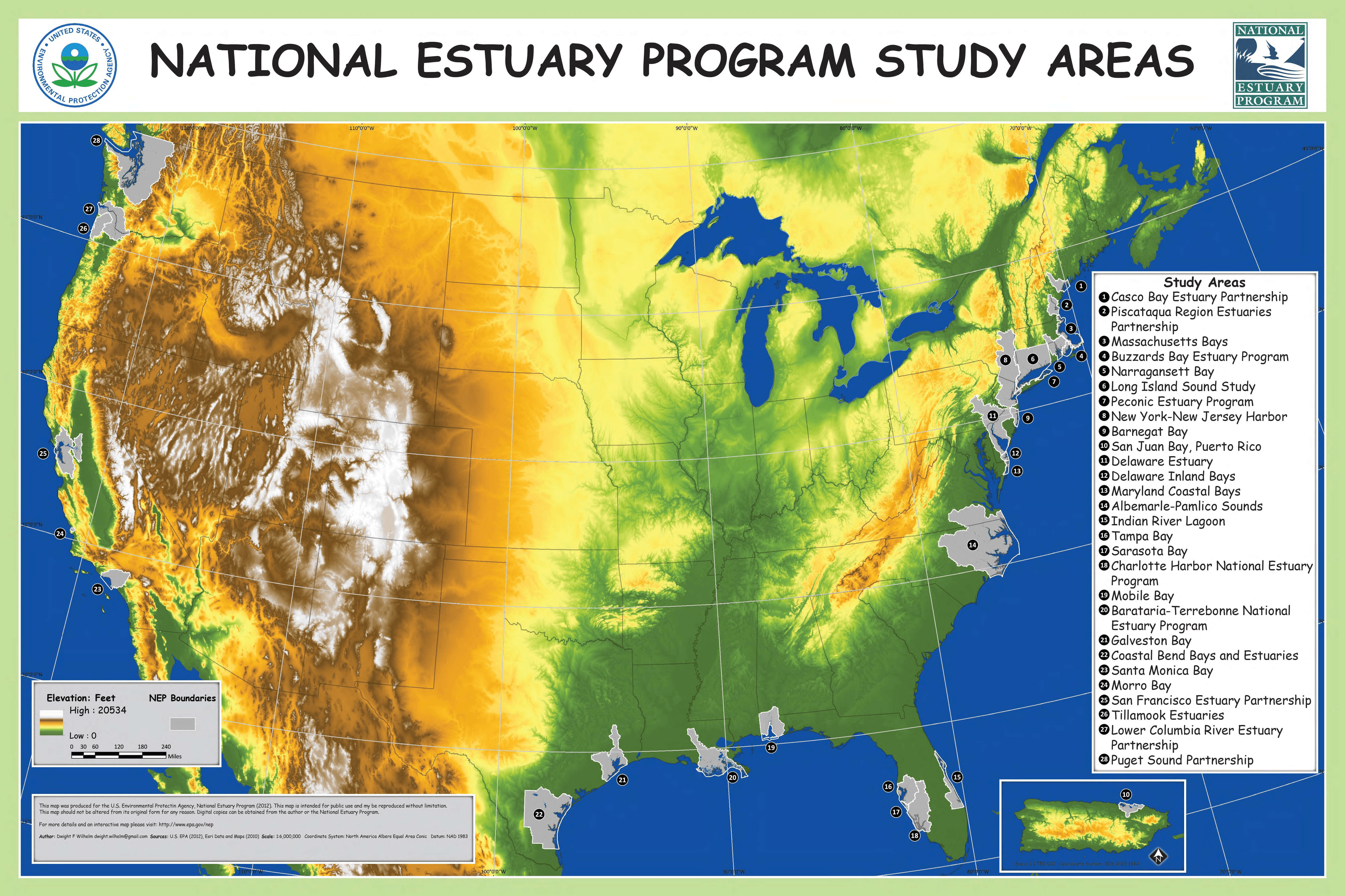
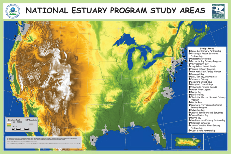
Image: NEP Study Areas Map 2015
Size of this preview: 800 × 533 pixels. Other resolutions: 320 × 213 pixels | 5,400 × 3,599 pixels.
Original image (5,400 × 3,599 pixels, file size: 12.75 MB, MIME type: image/png)
Description: Map of 28 local study areas in the U.S. National Estuary Program.
Title: NEP Study Areas Map 2015
Credit: U.S. Environmental Protection Agency, https://www.epa.gov/nep/printable-map-national-estuary-program-study-areas
Author: U.S. Environmental Protection Agency, Washington, D.C. National Estuary Program.
Usage Terms: Public domain
License: Public domain
Attribution Required?: No
Image usage
The following page links to this image:

All content from Kiddle encyclopedia articles (including the article images and facts) can be freely used under Attribution-ShareAlike license, unless stated otherwise.