Image: NEAT GBT engl crop

Size of this preview: 695 × 600 pixels. Other resolutions: 278 × 240 pixels | 701 × 605 pixels.
Original image (701 × 605 pixels, file size: 1.03 MB, MIME type: image/png)
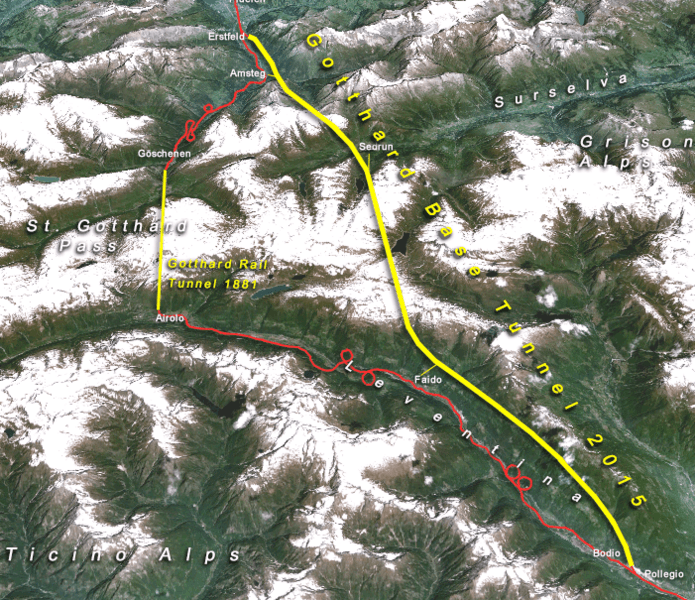
Description: Situation of the northern part of the Gotthard axis as part of the New Railway Link through the Alps NRLA / Alptransit project in Switzerland with Gotthard and Zimmerberg base tunnels (yellow: major tunnels, red: existing main tracks, numbers: year of completion)
Title: NEAT GBT engl crop
Credit: topomap: produced with NASA WorldWind 1.3 / overlay drawing by: Cooper.ch
Author: --Cooper.ch 19:30, 12 August 2006 (UTC)
Permission: NASA satellite imagery is in public domain, and so is my overlay drawing
Usage Terms: Creative Commons Attribution-Share Alike 4.0
License: CC BY-SA 4.0
License Link: https://creativecommons.org/licenses/by-sa/4.0
Attribution Required?: Yes
Image usage
The following page links to this image:

All content from Kiddle encyclopedia articles (including the article images and facts) can be freely used under Attribution-ShareAlike license, unless stated otherwise.
