
Image: NCRY map 1863
Size of this preview: 450 × 600 pixels. Other resolutions: 180 × 240 pixels | 720 × 960 pixels.
Original image (720 × 960 pixels, file size: 516 KB, MIME type: image/jpeg)
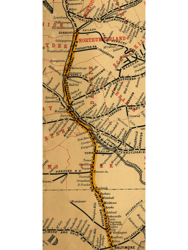
Description: Map of Northern Central Railway. The railroad came under the control of the Pennsylvania Railroad in 1861. Original map cropped and NCRY line highlighted.
Title: NCRY map 1863
Credit: This map is available from the United States Library of Congress's Geography & Map Division under the digital ID g3791p.rr000900. This tag does not indicate the copyright status of the attached work. A normal copyright tag is still required. See Commons:Licensing for more information.
Author: Barrington, W.
Usage Terms: Public domain
License: Public domain
Attribution Required?: No
Image usage
The following page links to this image:

All content from Kiddle encyclopedia articles (including the article images and facts) can be freely used under Attribution-ShareAlike license, unless stated otherwise.