
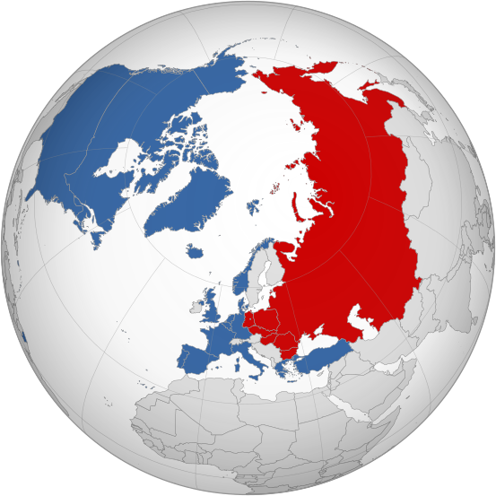
Image: NATO vs. Warsaw Pact (1949-1990)

Size of this PNG preview of this SVG file: 553 × 553 pixels. Other resolution: 240 × 240 pixels.
Original image (SVG file, nominally 553 × 553 pixels, file size: 342 KB)
Description: English: Border of NATO and Warsaw Pact in contrast to each other from 1949 (formation of NATO) to 1990 (withdrawal of East Germany). This map is based on File:BlankMap-World-Atlantic-(1949-1990).svg.
Title: NATO vs. Warsaw Pact (1949-1990)
Credit: Own work
Author: Discombobulates
Usage Terms: Creative Commons Attribution-Share Alike 4.0
License: CC BY-SA 4.0
License Link: https://creativecommons.org/licenses/by-sa/4.0
Attribution Required?: Yes
Image usage
The following 3 pages link to this image:

All content from Kiddle encyclopedia articles (including the article images and facts) can be freely used under Attribution-ShareAlike license, unless stated otherwise.
.svg)