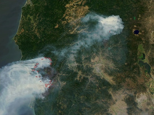
Image: NASA Biscuit fire
Description: Satellite picture of the Biscuit Fire (2002) — in the Rogue River-Siskiyou National Forest, in California and Oregon. Over 500,000 acres (200,000 ha) of the eastern portion of the Chetco River watershed, and surrounding regions of the western Rogue River and other watersheds, were destroyed in the wildfire. It burned most of the Kalmiopsis Wilderness (180,000 acres [728 km²]) . Taken using MODIS via the Aqua Satellite on August 12, 2002, with actively burning areas outlined in red.
Title: NASA Biscuit fire
Credit: [1]; transferred from en.wikipedia to Commons by User:Jsayre64 using CommonsHelper.
Author: The original uploader was Big Smooth at English Wikipedia.
Permission: PD-USGOV-NASA. "Image courtesy Jacques Descloitres, MODIS Land Rapid Response Team at NASA GSFC".
Usage Terms: Public domain
License: Public domain
Attribution Required?: No
Image usage
The following page links to this image:


