
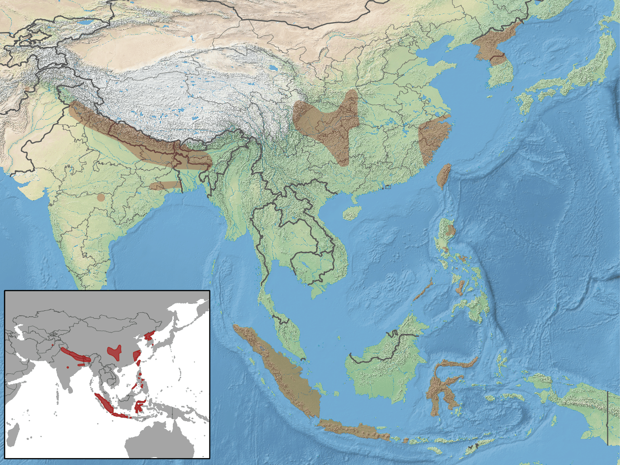
Image: Myotis formosus distribution
Description: geographic distribution of Myotis formosus
Title: Myotis formosus distribution
Credit: map data: http://www.naturalearthdata.com/downloads/ distribution data: http://www.iucnredlist.org/details/14160/0
Author: map data: Made with Natural Earth. Free vector and raster map data @ naturalearthdata.com. distribution: Francis, C., Bates, P., Csorba, G., Molur, S. & Srinivasulu, C. 2008. Myotis formosus. In: IUCN 2012. IUCN Red List of Threatened Species. Version 2012.2. <www.iucnredlist.org>. Downloaded on 24 October 2012. compilation: rbrausse
Permission: The use of spatial data from the IUCN Red List web site to produce species distribution maps is subject to the Attribution-Share Alike Creative Commons License. In short: you are free to distribute and modify the file as long as you attribute its authors and the IUCN Red List.
Usage Terms: Creative Commons Attribution-Share Alike 3.0
License: CC BY-SA 3.0
License Link: https://creativecommons.org/licenses/by-sa/3.0
Attribution Required?: Yes
Image usage
The following page links to this image:
