
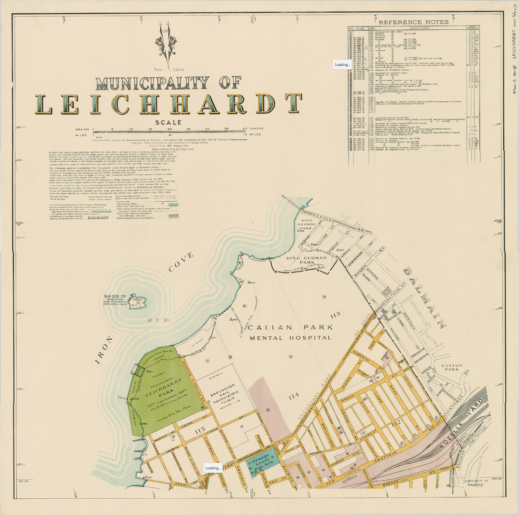
Image: Municipality of Leichhardt Map, printed 1939
Size of this preview: 604 × 599 pixels. Other resolutions: 242 × 240 pixels | 1,715 × 1,701 pixels.
Original image (1,715 × 1,701 pixels, file size: 1.94 MB, MIME type: image/jpeg)
Description: Municipality of Leichhardt Map, printed 1939. Page 1 of 2. The boundaries were proclaimed 3 December 1913. The map was printed 18 January 1939.
Title: Municipality of Leichhardt Map, printed 1939
Credit: http://digital.sl.nsw.gov.au/delivery/DeliveryManagerServlet?embedded=true&toolbar=false&dps_pid=IE3738875
Author: Department of Lands, Sydney
Usage Terms: Public domain
License: Public domain
Attribution Required?: No
Image usage
The following page links to this image:

All content from Kiddle encyclopedia articles (including the article images and facts) can be freely used under Attribution-ShareAlike license, unless stated otherwise.