
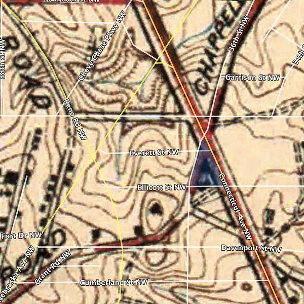
Image: Muhlenberg Park street map

Size of this preview: 600 × 600 pixels. Other resolutions: 240 × 240 pixels | 1,160 × 1,160 pixels.
Original image (1,160 × 1,160 pixels, file size: 1.32 MB, MIME type: image/jpeg)
Description: A 1917 (1926 reprint) U.S. Geological Survey map (surveyed 1913-1915), of the current site of Muhlenberg Park in Washington, D.C. (highlighted), overlaid with modern street names.
Title: Muhlenberg Park street map
Credit: Own work
Author: Rockhead126
Usage Terms: Creative Commons Attribution-Share Alike 4.0
License: CC BY-SA 4.0
License Link: https://creativecommons.org/licenses/by-sa/4.0
Attribution Required?: Yes
Image usage
The following page links to this image:

All content from Kiddle encyclopedia articles (including the article images and facts) can be freely used under Attribution-ShareAlike license, unless stated otherwise.