
Image: MtChurchill-CalderaRim
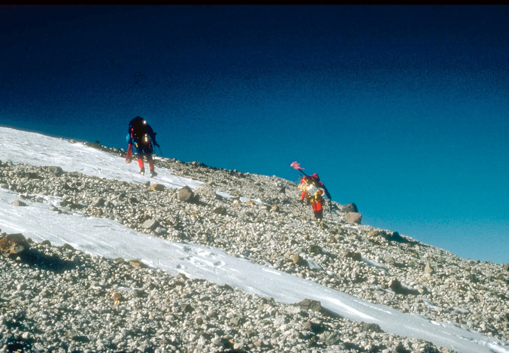
Description: U.S. Geological Survey climbing party reaching the east rim of the summit caldera on 4,766-m (15,636 ft)-high Mount Churchill, site of two of the most voluminous explosive eruptions in North America in the past 2,000 years. Blocky debris in the photo consists of pumice and lithic fragments ejected 1,250 years ago. This deposit forms the eastern lobe of the White River Ash. Wrangell-St. Elias National Park and Preserve, Alaska, USA
Title: MtChurchill-CalderaRim
Credit: http://pubs.usgs.gov/dds/dds-39/
Author: G. Dubois, U.S. Geological Survey
Permission: This image is in the public domain in the United States because it only contains materials that originally came from the United States Geological Survey, an agency of the United States Department of the Interior. For more information, see the official USGS copyright policy.
Usage Terms: Public domain
License: Public domain
Attribution Required?: No
Image usage
The following page links to this image:
