
Image: Mt. Kinesava geologic map

Size of this preview: 569 × 599 pixels. Other resolutions: 228 × 240 pixels | 2,191 × 2,307 pixels.
Original image (2,191 × 2,307 pixels, file size: 7.99 MB, MIME type: image/png)
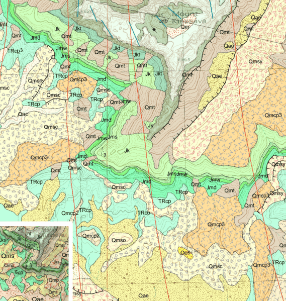
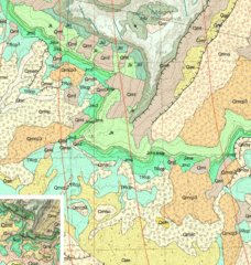
Description: Geologic map of the south slope of Mt. Kinesava in Zion National Park, 1:24,000 scale, inset with a map of the exact same area, 1:100,000 scale, showing differences in detail. Both maps published by Utah Geological Survey, public domain. Created to illustrate Cartographic generalization.
Title: Mt. Kinesava geologic map
Credit: https://ugspub.nr.utah.gov/publications/geologicmaps/30x60quadrangles/m-242.pdf
Author: Utah Geological Survey
Permission: Utah Government Records and Management Act
Usage Terms: Public domain
License: Public domain
Attribution Required?: No
Image usage
The following page links to this image:

All content from Kiddle encyclopedia articles (including the article images and facts) can be freely used under Attribution-ShareAlike license, unless stated otherwise.