
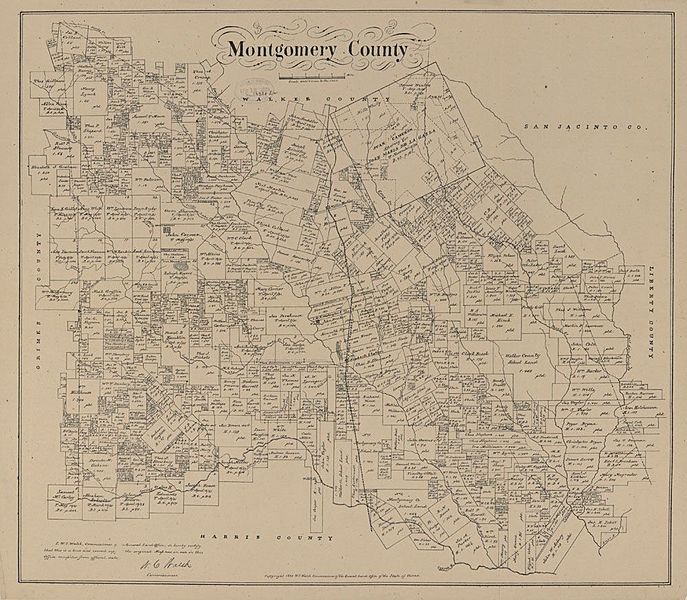
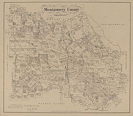
Image: Montgomery County Texas Map

Size of this preview: 687 × 600 pixels. Other resolutions: 275 × 240 pixels | 1,000 × 873 pixels.
Original image (1,000 × 873 pixels, file size: 192 KB, MIME type: image/jpeg)
Description: Map of Montgomery County, Texas, which Gilbreath was tasked with reconstructing in 1869
Title: Montgomery County Texas Map
Credit: Pritzker Military Museum & Library
Author: Pritzker Military Museum and Library
Usage Terms: Public domain
License: Public domain
Attribution Required?: No
Image usage
The following page links to this image:

All content from Kiddle encyclopedia articles (including the article images and facts) can be freely used under Attribution-ShareAlike license, unless stated otherwise.