
Image: Mixtecos

Size of this preview: 800 × 587 pixels. Other resolutions: 320 × 235 pixels | 1,031 × 757 pixels.
Original image (1,031 × 757 pixels, file size: 312 KB, MIME type: image/png)
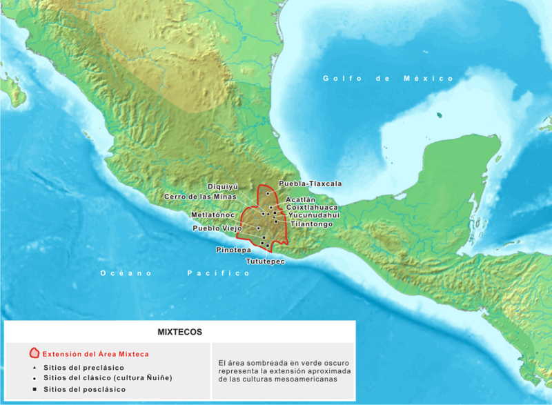
Description: Mapa donde se detallan los sitios asociados a la cultura mixteca, que se desarolló en Mesoamérica entre los siglos XV adC y XVI dC
Title: Mixtecos
Credit: Trabajo propio, basado en cartografía producida por Koba-chan
Author: Yavidaxiu
Permission: Public domainPublic domainfalsefalse I, the copyright holder of this work, release this work into the public domain. This applies worldwide. In some countries this may not be legally possible; if so: I grant anyone the right to use this work for any purpose, without any conditions, unless such conditions are required by law.
Usage Terms: Public domain
License: Public domain
Attribution Required?: No
Image usage
The following 2 pages link to this image:

All content from Kiddle encyclopedia articles (including the article images and facts) can be freely used under Attribution-ShareAlike license, unless stated otherwise.