
Image: Milton Keynes Redway
No higher resolution available.
Milton_Keynes_Redway.gif (625 × 543 pixels, file size: 219 KB, MIME type: image/gif)
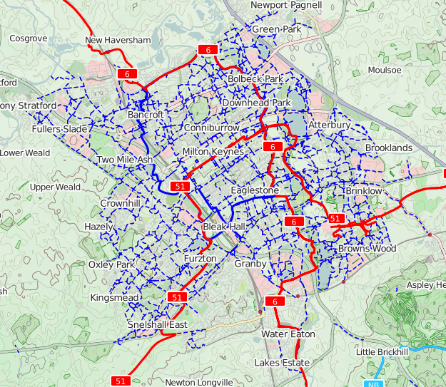
Description: A map of the Milton Keynes Redway system, a network of (combined) segregated cycleways and footways.
Title: Milton Keynes Redway
Credit: Extract from OpenStreetMap cycle layer
Author: Map data © OpenStreetMap contributors; Cartographic design and rendering (OpenCycleMap) by ThunderForest; Extract by user:John Maynard Friedman
Permission: Creative Commons Attribution-ShareAlike 2.0
Usage Terms: Creative Commons Attribution-Share Alike 2.0
License: CC BY-SA 2.0
License Link: http://creativecommons.org/licenses/by-sa/2.0
Attribution Required?: Yes
Image usage
The following page links to this image:

All content from Kiddle encyclopedia articles (including the article images and facts) can be freely used under Attribution-ShareAlike license, unless stated otherwise.