
Image: Miletus Bay silting evolution map-en

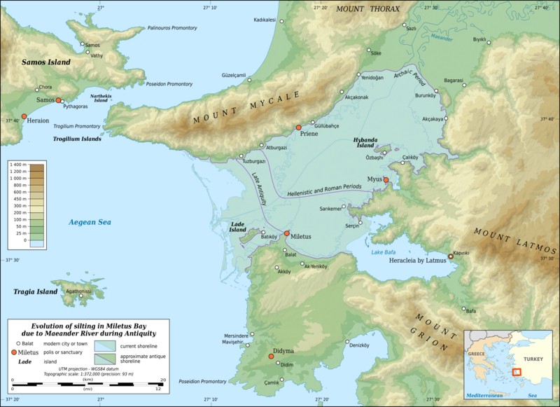
Description: Map in English showing the silting evolution of Miletus Bay due to the alluvium brought by the Maeander River during Antiquity. Are also displayed some of the modern cities and towns of the area, the current course of the Maeander River and the current shoreline. Notes: The background map and shaded relief are raster images embedded in the SVG file. The shoreline limits crossing the valley are approximate.
Title: Miletus Bay silting evolution map-en
Credit: Own work Landsat 7 ETM+ imagery; NASA SRTM3v2 data; Additional reference: Barrington atlas of the Greek and Roman World.
Author: Eric Gaba (Sting - fr:Sting)
Permission: Attribution and Share-Alike required Any use of this map can be made as long as you credit me (Eric Gaba – Wikimedia Commons user: Sting) as the author and distribute the copies and derivative works under the same license(s) that the one(s) stated below. A message with a reply address would also be greatly appreciated.
Usage Terms: Creative Commons Attribution-Share Alike 3.0
License: CC BY-SA 3.0
License Link: https://creativecommons.org/licenses/by-sa/3.0
Attribution Required?: Yes
Image usage
The following page links to this image:
